GLOBAL SYSTEMS

GREATEST PLACES HOME


Explore the !narra plant of the Namib desert through Starlogo

INSIDE SYSTEMS


How does the Namib desert compare with the land around Georgia? We asked Charlie Fitzpatrick at ESRI (Environmental Systems Research Institute) and here are the Global Information System (GIS) maps he sent us.

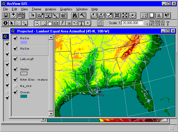
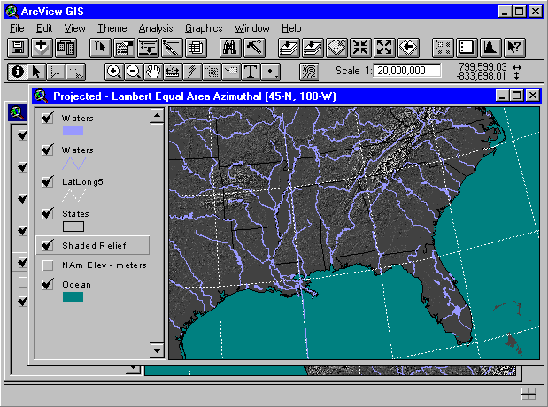
Southeastern United States
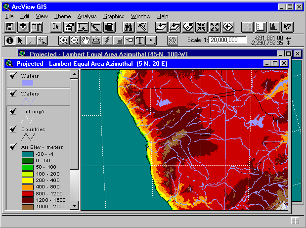
Namibia

We asked: Why does the amount of water in the Namib desert look similar to that for the lush southern United States?

Charlie: " The rivers you're seeing are 'unclassified,' so there are probably some that are at best seasonal. We have exhaustive information about rivers and their streamflow in the United States For Namibia, I don't have access to anything more than where the basic rivers (or beds) are and sometimes an indication they are only seasonal."

We wondered if he could send us population maps for each area with more detailed information.

Charlie: "Any project in GIS depends on data. If the data are available, life is good; if not, challenges begin.

"The data for the United States are deep, rich, high quality, and largely free. For the rest of the world, even as near as Canada, you start to lose some of those characteristics. Population data is often difficult to obtain for countries, especially for 'developing world' areas. What you're seeing is the best data available at a global level. We can zoom in even closer, but you'll get to the point where you're doing what amounts to looking at a wood-block puzzle of Africa using a magnifying glass: You can see things closer, but you don't get any more information. We may be able to supplement the general density map with some point information about cities and villages, but we won't be able to get the equivalent of the United States county and census tract information about population, unless you have a source who is willing to provide those data."

Icon for ArcView

picture of book

Termites systems image

Understanding GIS:
Visit ESRI--where Charlie works--and try the ArcView GIS software he used to generate the maps above.

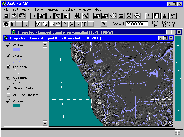
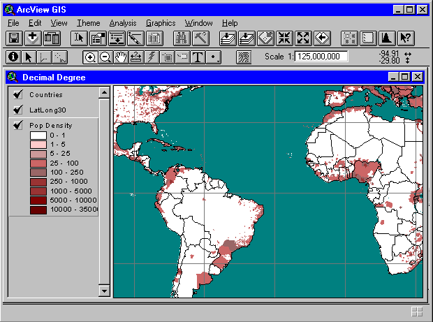
A straightforward explanation of GIS:
Take this link to a well-thought-out manual.

Make computer models of systems:
Download
StarLogo software from the MIT Media Lab to create your own computer models of systems.


| activities | discussions | postcards | film | places |
|
Cecil's notes | add your place | contents |

Greatest Places Online ©1999 Science Museum of Minnesota